• Avian

PinPoint GPS Iridium for birds

  • Product Type Icon Tag

GPS with global remote download

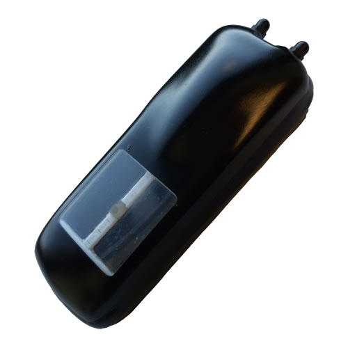
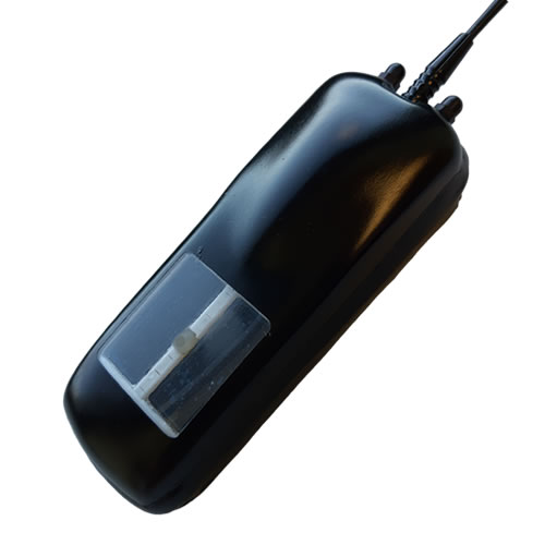
PinPoint GPS Iridium tags combine many of the great features of PinPoint GPS tags with the ability to download data with more consistent satellite coverage. The Iridium network is the largest commercial satellite network in the world offering true global communications. This means the PinPoint Iridium tags can be used when your focus animals are in remotest of areas, for example where there is no mobile phone networks. With add-on features such as 2-way communication, you can remotely change or update the GPS schedule on your deployed tags. Contact one of our telemetry experts to help you design the optimal tag for your study needs.


Options

  • More positions (while maintaining accuracy and fix success rate)
  • 2-way communication of schedules
  • Activity data
  • Alerts or different GPS schedule when in a Virtual Fence
  • VHF beacon for regular monitoring
  • Product Features

    Consistent Satellite Coverage
    The Iridium satellite constellation (www.iridium.com)
    has constant satellite availability, so there is better coverage at the equator, no need to wait for satellite passes, and greater redundancy than other satellite constellations. This means that there is greater download reliability, and the ability to choose when to upload your data. 24/7 global coverage.

    Efficient Data Transfer
    Exchanging data with the Iridium system is efficient as handshakes determine what data has been transferred. Therefore look forward to more locations and extra sensor data.

    Remotely Upload New Schedules (chargeable option)
    Because the Iridium system allows 2-way communications, your tags can be configured to allow a new schedule or other user-chosen parameters (e.g. new virtual fence) to be uploaded after it has been deployed. So if you see that the bird is moving into an area you are interested in, you can increase the GPS locations, and reduce again afterwards, according to the behaviour you are wanting to record.

    No External Antenna
    Both the GPS receiving antenna and the Iridium transmitting antenna are contained within the housing, eliminating the risk of antenna damage that is always a concern with whip antennas on other technologies.

    Flexible Scheduling

    As with all our PinPoint GPS tags, a user-friendly PinPoint Host allows you to schedule GPS location records when you want, as well as how frequently to upload data or schedule the VHF beacon (if fitted).

    Sensors
    Receive temperature, mortality and even proximity data.

    Movement Alerts
    Alerts can be sent, or even schedules changed, when your bird enters or leaves a Virtual Fence defined by you. Only available with standard locations processed on board.

    Swift Locations
    Swift locations (or fixes) are more efficient than standard locations, so the tag can record more of them, although they can not be used for virtual fences.

    Virtual Fences
    Program different GPS schedules according to whether the bird is within an area specified by you.  For example, you may not need so many locations when the bird is near the nest, so you have longer intervals between GPS locations, but when it leaves the area around the nest you can record locations more frequently.

  • Product Applications

    PinPoint Iridium tags have significant advantages over other GPS tags, having a global 24/7 ability to receive data, and a much more efficient data transfer protocol, which will increase the amount of data you can get from remote download.

    Suitable for species that can carry a tag of 40g or more.

  • Product Specifications

    Model PinPoint Iridium 200 PinPoint Iridium 850
    Weight (g) 40 65
    Size (LxWxH) (mm) 73 x 36 x 27 88 x 39 x 37
    Potential fixes per day [1]
    Life Standard fixes Swift fixes Standard fixes Swift fixes
      1 month 12 24 96 144
      2 months 5 12 36 72
      3 months 3 10 24 48
      6 months 1 4 7 20
      12 months 2 3 10

    1. Locations may be attempted but the bird’s behaviour can prevent GPS acquisition and upload. Number of location attempts are approximate and schedule dependent. Operating life can be further increased by decreasing the frequency of iridium transmission (more positions in the record) and/or decreasing average time when VHF Beacon is on. For help with your application, contact one of our specialists.

    There is no external antenna unless a VHF beacon is required.

    A PinPoint DLC is required for scheduling, and downloading test data and accessing locations if recovered after deployment.

    Remote data is accessed through our secure data portal.


    Technical specifications:
    Operating temperature: -5˚C to +50˚C
    VHF beacon option: -10˚C to +35˚C
    Battery: One-time use.

  • Product Downloads

Next Steps

Get in Touch about PinPoint GPS Iridium for birds


Contact Us
  • By submitting this message you are agreeing to Lotek’s Privacy Policy, and we will handle your contact details as described in this policy. If you prefer not to receive marketing emails from Lotek about our products and services, you can opt-out of all marketing communications at any time.